Главная страница Случайная страница
Разделы сайта
АвтомобилиАстрономияБиологияГеографияДом и садДругие языкиДругоеИнформатикаИсторияКультураЛитератураЛогикаМатематикаМедицинаМеталлургияМеханикаОбразованиеОхрана трудаПедагогикаПолитикаПравоПсихологияРелигияРиторикаСоциологияСпортСтроительствоТехнологияТуризмФизикаФилософияФинансыХимияЧерчениеЭкологияЭкономикаЭлектроника
Read the text. 1. Surveyingmeans complex activities to determine the position of constructed objects in relation to the earth surface
|
|
1. Surveying means complex activities to determine the position of constructed objects in relation to the earth surface. An important aspect of construction is track geometry. Track geometry - a horizontal andvertical location of track as measured to survey marks. Alignment (Figure 2.2) - a track geometry projected onto the horizontal plane. Longitudinal profile (Figure 2.3) - a track geometry projected onto the longitudinal vertical plane.
| 
|
| Figure 2.2 | Figure 2.3 |
Trackis designed using standard geometric shapes. Circular curves and straight lines form the basis of the track with transitions forming a gradual joining of them and are used in horizontal plane. Gradesand vertical curves are specific features of vertical plane.
2.Surveying activitiesare of two major types: economic and technical. Economic activities include the volume of traffic to be expected from the area served by the new line, position/direction of the new line, construction cost efficiency. Technical/engineering activities involved in the survey of the new line comprise geological, soil-science, hydrological, climatic and other investigations.
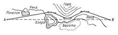
3. A reconnaissance is generally based on topographical maps; they show the plani-metry and drainage of the area. After studying the maps survey engineers get a general idea of the country, whether it is flat or broken. The next step is to ascertain with the aid of leveling instruments the altitudes of the saddles and the points along valleys to record their natural gradients. Notes are also made on the various kinds of terrain, materials to be excavated and rivers behavior during freeze-up and ice drift, flood and high water. With all this information the preliminary survey begins. It is based on trace of levels along the selected route. No curves are used. The trace consists of a series of straights with marked pegs. Levels are noted at all pegs which are checked one against another. In this way the trace can be plotted without any error. The area of land extending to the railway boundaries is known as a right-of-way.
4. All engineering surveys are carried out with the use of new technologies (air, ground, mobile, laser scanning, photographic aerial survey of high resolution, modern geo-radar surveying).
5. Surveying is the basis for designing. Design work provides the whole-range proper documentary support of projects. Design specialists develop engineering solutions, standards, guidelines and sample materials to arrange methodological support of design process and unit operation. It concerns:
- track and traffic capacity;
- safe and uninterrupted train movement;
- substantiation of investments;
- possibility of further reconstruction or renewal projects;
- up-to-date methods of construction;
- environment protection.
|
|